
What does the St. Joseph Peninsula beach nourishment and breakwater project mean for buyers?
It's great news. A roughly $34.5 million investment just placed about 830,000 cubic yards of sand along 1.1 miles of southern Cape San Blas shoreline near the Stumphole revetment and added eight submerged breakwaters built to hold that sand in place. For buyers, that means a wider protective beach, a rebuilt dune, and a shoreline engineered to erode more slowly in the project area. It's a real vote of confidence in the peninsula. Smart buyers still confirm a parcel's flood zone, CBRA status, and insurance separately, and that's easy to do. Because the benefit is strongest in the southern project limits, where a parcel sits is worth checking, and that's exactly the kind of thing I'll walk through with you on the ground.
By Billy Joe Smiley
If you've been watching property on Cape San Blas this spring, you've probably heard the dredges working, and that sound is good news. That's the St. Joseph Peninsula Beach Nourishment and Coastal Structures Project, the largest single coastal project Gulf County has ever taken on. The beach fill portion wrapped up in early May 2026, and the breakwater work is finishing through the summer. When a county and its state and federal partners commit this kind of money to a stretch of coastline, that's a real vote of confidence in the southern Cape, and buyers keep asking me what it means for them.
Here's the encouraging version, the way I'd walk you through it standing on the sand.
What the project actually is
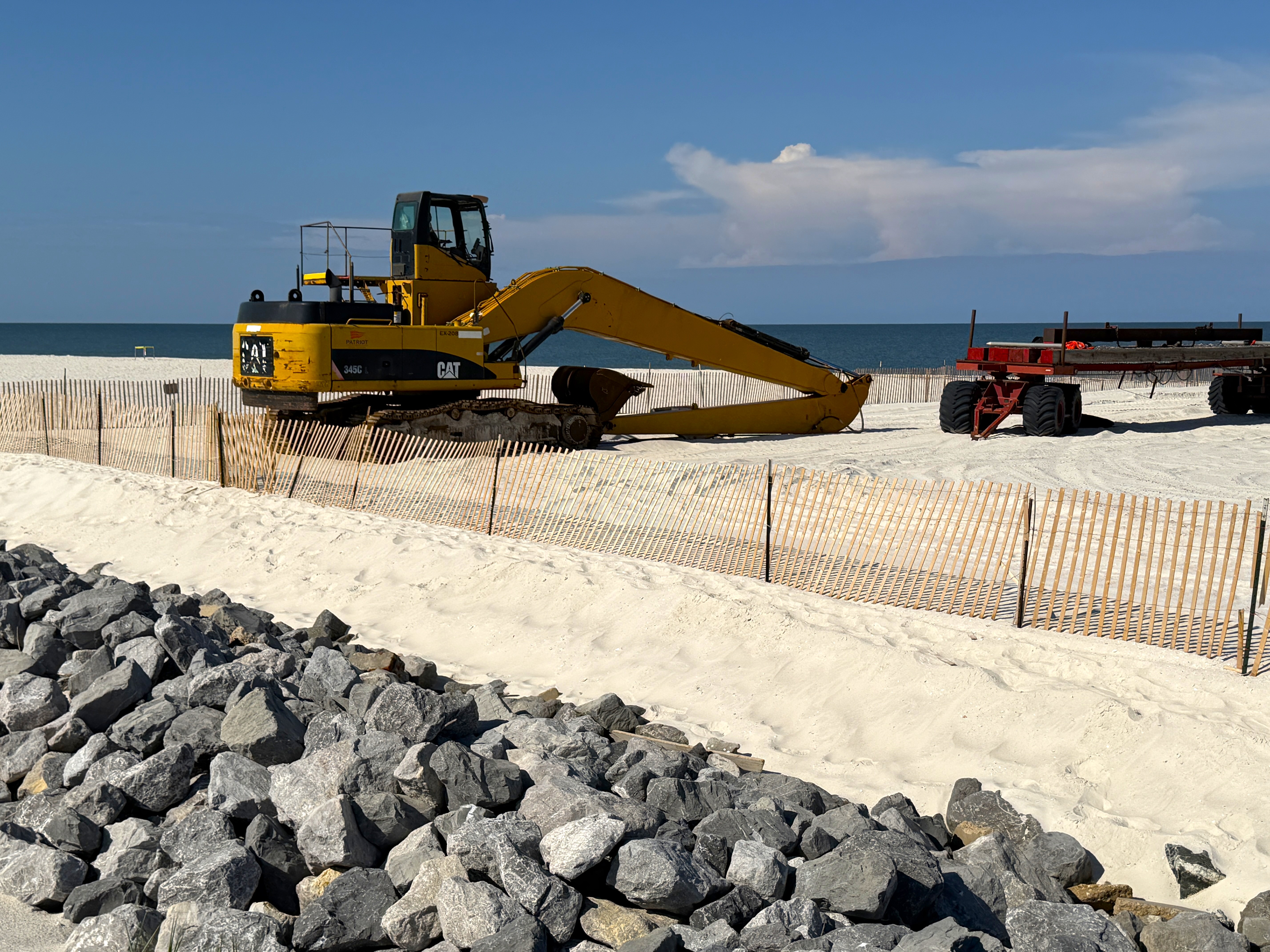
Two good things are happening at once. First, beach nourishment: a dredge pulled sand from an offshore borrow area and pumped it onto the beach to rebuild the dune and widen the shoreline. Second, coastal structures: a series of low rock breakwaters built just offshore, sitting under the water, designed to slow the waves and keep the new sand on the beach longer. Together they give this stretch of the peninsula more beach and a better chance of holding it.
The numbers, confirmed through the official Gulf County and MRD Associates project updates, tell a strong story:
| Element | Detail |
|---|---|
| Total project cost | Approximately $34.5 million, funded through county, state, and federal sources |
| Sand placed | About 830,000 cubic yards along roughly 1.1 miles of shoreline |
| Location | Southern peninsula, just north of the Stumphole revetment (roughly reference monuments R-100 to R-105.5) |
| Breakwaters | Eight submerged rock breakwaters built offshore |
| Timing | Beach fill completed May 3, 2026; breakwater construction finishing through summer 2026 |
For context, the southern peninsula lost more than 1.3 million cubic yards of sand between 2019 and 2023, which made it the most erosion-prone part of the Cape for years. That's exactly why this project matters so much. It's the county's direct answer to that history, and the eight breakwaters are the powerful new piece that wasn't part of the last nourishment back in 2019. Buyers are right to read this as the area investing in its own future.
.jpg)
What it means for a buyer, in plain terms
For buyers looking at the southern project area, the upside is real: a wider beach, a rebuilt dune in front of the homes, and a shoreline designed to hold its sand longer than a nourishment alone would. The engineers behind the project predict the breakwaters can retain sand on the beach as much as 50 percent longer over a six-year period compared with a stand-alone fill, and the original feasibility work estimated background erosion rates could drop by as much as 40 percent with structures in place. Those are design projections rather than guarantees, and a strong storm can still reshape any beach in a single season, so it's fair to treat them as the engineers' best estimate. Even read conservatively, the direction is encouraging.
- More buffer between the Gulf and the structure. A deeper dune and beach give a home more room before waves reach the foundation in a storm. That's genuine peace of mind on a coastline that takes direct weather.
- A longer runway between nourishment cycles. Periodic re-nourishment is part of life on this coast, and the breakwaters are built to stretch the time between those projects, which is a positive for the long-term cost picture in the area.
- A more stable shoreline to plan around. If you're buying to hold for years or to build, a shoreline engineered for slower erosion is far easier to plan a long-term investment around, and that stability is worth a lot.
One helpful thing to expect, so it reads as reassuring rather than surprising: the freshly pumped beach looks dramatically wide right after construction, then narrows over the following months. That's by design and a sign the project is working exactly as planned. The sand shifts out to a nearshore sandbar and the profile settles into its long-term shape, building the underwater foundation that protects the beach. A narrower dry beach a few months out is normal and healthy, not a sign anything went wrong.
What to confirm separately, and how easy it is
- Flood zone is set by FEMA, not by beach width, so we confirm it directly. A home in a VE or AE zone stays in that zone after the project, because flood zone designations come from FEMA's mapping. The good news is that this is a known, lookup-able fact, and smart buyers simply pull it on the address so there are no surprises.
- CBRA status is a separate designation, so we check it on the parcel. Parts of the peninsula and Indian Pass sit in a Coastal Barrier Resources Act zone where federal NFIP flood insurance isn't available and a private policy fills the gap. Beach work doesn't touch that boundary, and confirming it early is quick and keeps your numbers clean.
- Wind, flood, and homeowners are three policies, so we get real quotes. On a beach home here those are three separate policies, and the total runs into the thousands. The smart move is simply to get firm quotes on the specific address during your due diligence window, because underwriters price wind and flood off elevation, construction, and zone. You build that into the plan and move forward with eyes open.
- The benefit is strongest in the southern stretch, so location is worth confirming. The protection is concentrated in the roughly 1.1 mile southern project area near the Stumphole revetment, so it's worth knowing exactly where a parcel sits relative to those limits. That's a quick check, and it tells you how much direct benefit a specific home is getting.
If you want the full picture on coverage, my breakdown of wind insurance on a Forgotten Coast beach home walks through what those three policies actually cost and how to plan for them with confidence.
How to buy with confidence after the project
- Confirm the parcel sits inside the project limits. The strongest benefit lives in the southern stretch near the Stumphole revetment, so we check the home's location against the project footprint together.
- Pull the flood zone and elevation certificate. A VE zone carries the strictest requirements and the highest premiums, while an X zone may carry no mandatory flood insurance, so knowing the zone is pure clarity.
- Check the CBRA status. If the parcel is in a CBRA zone, you simply plan on a private flood policy instead of NFIP. Knowing this early sharpens your numbers and can even strengthen your offer.
- Get firm insurance quotes on the address. Wind, flood, and homeowners, quoted on the specific property during your due diligence window. Real quotes give you a real budget and full confidence going in.
- Look at the survey and the home's distance to the Gulf. Where the structure sits relative to the dune line and the Coastal Construction Control Line shapes both your protection and what you can do with the lot later.
This is the same confident groundwork I cover when buyers ask how close to the Gulf you can buy on Cape San Blas and what to know before you commit to waterfront property on the Cape. With the leverage buyers have in the 2026 Forgotten Coast market, a clear, confident read on coastal protection is one more thing working in your favor at the negotiating table.
Frequently Asked Questions
Does the beach nourishment project lower flood insurance on Cape San Blas?
The project is a real plus for shoreline protection, and flood insurance simply runs on a separate track. It's priced off your flood zone, elevation, and construction, which the project doesn't change, so you confirm those directly on the address. The wider beach and rebuilt dune lower real-world erosion risk, and the smart move is to get firm quotes during due diligence so your budget is solid going in.
Which part of the peninsula benefits most from the project?
The work is concentrated along roughly 1.1 miles of the southern shoreline, just north of the Stumphole revetment near reference monuments R-100 to R-105.5. Homes inside that stretch get the strongest direct benefit from the new sand and the eight submerged breakwaters, and properties farther north still sit on the same peninsula.
Will the new beach stay as wide as it looks right now?
It will settle, and that's a sign of success. A nourished beach is built wider than its long-term shape, then narrows over the following months as sand shifts to the nearshore sandbar in a process called profile equilibration, building the protective underwater foundation. The eight submerged breakwaters are designed to slow that loss and hold sand on the beach longer than a fill alone would.
Is the southern end of Cape San Blas a good place to buy now?
Yes, and this project strengthens the case. It improves shoreline protection in the southern area and is designed to slow erosion there. To buy with full confidence, you simply confirm the parcel's flood zone, elevation, CBRA status, and real insurance quotes before you make an offer, and that's exactly the kind of homework I handle alongside you.
Will the peninsula need more beach nourishment after this?
Likely yes over time, and the breakwaters are built to make that less frequent. The eight structures are meant to retain sand longer and stretch the time between projects, which is good news for the long-term cost picture in the area.
Where this leaves you
The St. Joseph Peninsula project is genuinely good news for the southern Cape. A wider beach, a rebuilt dune, and eight breakwaters built to hold the sand give that stretch more buffer and a more stable shoreline to plan around, and a $34.5 million investment is a strong vote of confidence in the area.
If you're weighing a property near the project area, give me a call or shoot me a text. I'll walk the parcel with you, show you where the project limits fall, pull the flood zone and elevation, and help you price the real cost of owning there so you can move forward feeling great about it. After 27 years on this coast, helping a buyer read what a project like this means for one specific home is exactly the part I enjoy most.
About Billy Joe Smiley
Billy Joe Smiley is one of Florida's most accomplished real estate professionals, with over 27 years of experience and more than 1,000 properties sold. As a top 1% REALTOR® based at Port Realty Group, Billy Joe serves the Forgotten Coast with unmatched insight, professionalism, and care. He works with buyers and sellers across Port St. Joe, Cape San Blas, Mexico Beach, and St. George Island, specializing in luxury and waterfront homes, investment properties and 1031 exchanges, beachfront and bayfront land, vacation homes and income-producing real estate, and real estate development and architectural planning. A Gulf County native, Billy Joe pairs deep local knowledge with decades of experience in brokerage, land development, custom home building, and architectural consulting. Recognized as The Forgotten Coast's Most Trusted Realtor, Billy Joe has earned 90+ public reviews across Zillow, Google, and Realtor.com.
Enjoy this blog post? Click here to subscribe for updates
Leave A Comment